The Ocala Sizzle
Archives
National Hurricane Center Monitors Active Atlantic Storms
SIGN UP FOR OUR NEWSLETTER
National Hurricane Center Monitors Active Atlantic Storms |
Hurricane Humberto Strengthens; Invest 94L Shows Potential Development |
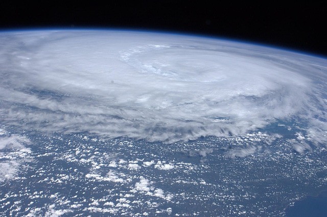
Hurricane Humberto has intensified, now boasting sustained winds of 75 mph, officially classifying it as a Category 1 hurricane.
Currently situated approximately 465 miles northeast of the Northern Leeward Islands, Humberto is progressing northwest at 3 mph.
Forecasters anticipate significant strengthening, with Humberto potentially escalating to a major hurricane over the weekend.
Projections suggest the storm will veer out to sea, remaining hundreds of miles from the U.S. East Coast.
Meanwhile, the National Hurricane Center is closely monitoring Invest 94L, a tropical wave near Hispaniola and the Turks and Caicos Islands.
This system exhibits a high likelihood of developing into a tropical depression or Tropical Storm Imelda in the coming days.
Invest 94L currently holds an 80% chance of development over the next 48 hours and a 90% chance over the next seven days.
Regardless of its development, heavy rains and gusty winds are expected to impact the Dominican Republic, Haiti, the Turks and Caicos Islands, the Bahamas, and Eastern Cuba.
Residents in these areas should remain vigilant and monitor updates from the National Hurricane Center.
In the Pacific, Hurricane Narda has formed, currently classified as a Category 1 storm.
While Narda remains over open water and poses no immediate threat to land, it is projected to intensify briefly before weakening.
Swells generated by Narda are expected to affect parts of Mexico, Baja California Sur, and southern California, potentially creating hazardous coastal conditions.
As the 2025 Atlantic hurricane season progresses, the National Hurricane Center continues to monitor and provide updates on these developing systems.
Residents in potentially affected regions are advised to stay informed and prepared. |

